Document Excavations with vialytics

Many municipalities still manage utility cuts and excavations through scattered, manual processes. With vialytics, you can document every project centrally, seamlessly, and with legal certainty—from the initial inspection to the completed repair.
 
Two construction workers inspecting a deep utility cut excavation in a paved road to ensure proper infrastructure maintenance and quality control.

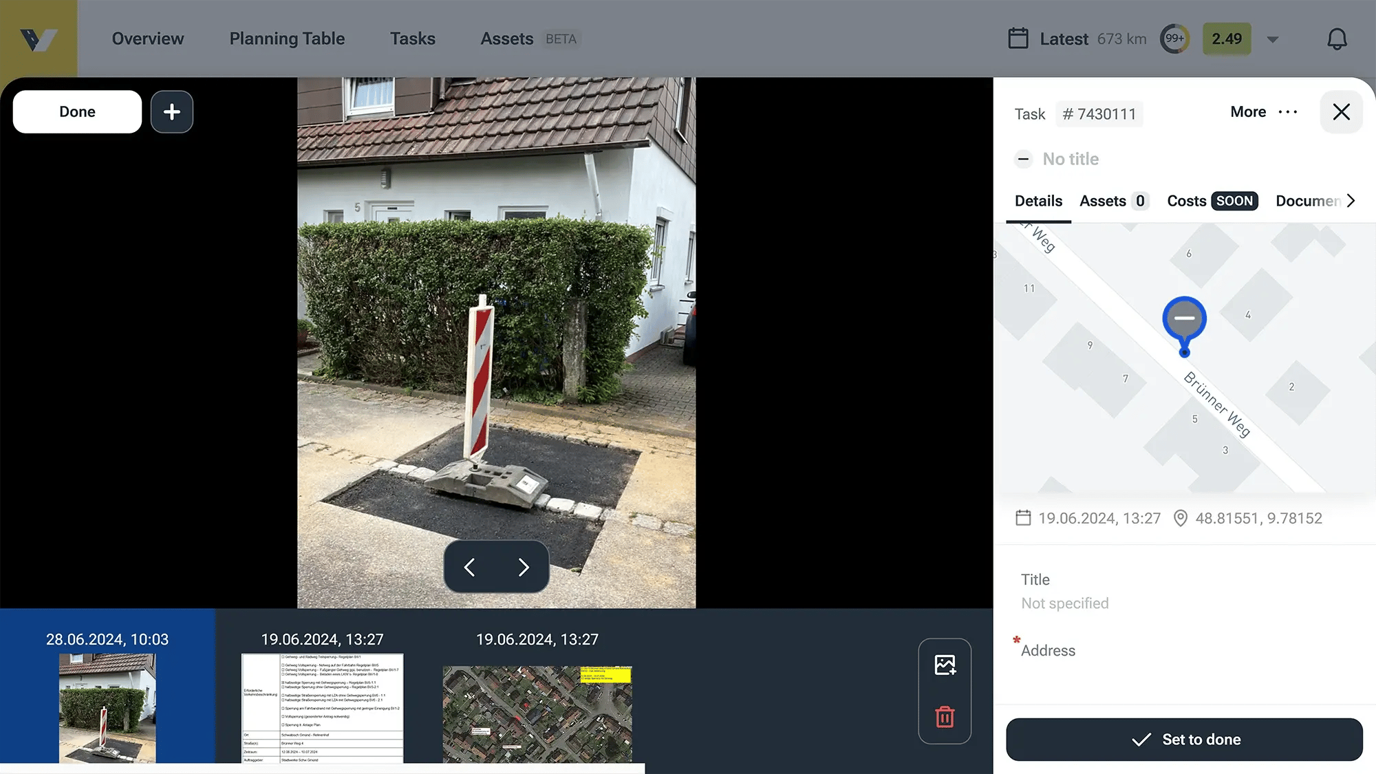
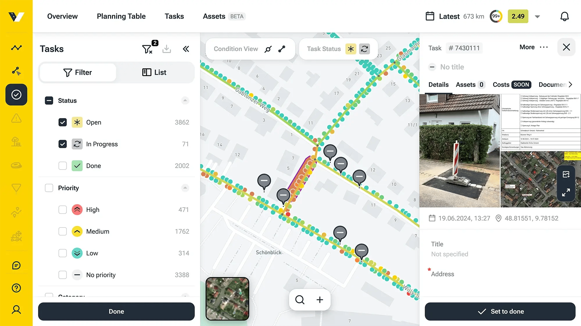
Utility cuts are unavoidable, but ruined roads aren't. Every excavation is a threat to your pavement's lifespan. The only way to prevent costly long-term damage is by holding contractors accountable through strict, consistent inspections.

Stay in the driver's seat: leverage clear workflows and modern documentation to keep total control over your infrastructure.

The Power of Bulletproof Documentation

Zero Liability

Meet every regulatory standard, prevent expensive pavement damage, and stop legal disputes before they even start.

No Blind Spots

Track every single phase of the utility cut. Instantly prove contractor compliance with hard, undeniable evidence.

Permanent Records

Your excavation data is stored securely for the long haul. Reconstruct timelines and prove your case, even years down the road.

Excavation Management in Action

Ironclad Field Documentation

Use the vialytics app to document every utility cut right where it happens. Structured, fast, and legally defensible.

âś” Geotagged proof: Field crews can instantly create location-based tasks and snap multi-angle photos on the spot.

✔ Effortless details: Add rich descriptions of the site's condition on the fly—using fast voice dictation or text.

âś” Seamless sync: Review, edit, and expand all field data from the comfort of your office via the web app.
The vialytics Web System interface displaying digital documentation for a utility cut, featuring a geotagged site photo, map location, and project management details.
Dashboard of the vialytics Web System showing a task list, map markers, and detailed photo documentation for road excavation management.

Seamless Documentation in the Web System

Every excavation is clearly marked with specific categories and can be quickly found and assigned in the vialytics web system at any time. Different construction phases are clearly displayed—such as "open," "in progress," or "completed."

All markers automatically contain the date, time, and exact location of the excavation, ensuring the entire process remains traceable at all times.

Command Central for Every Cut

Get the ultimate bird’s-eye view with the vialytics Web System. Every utility cut is permanently locked in with photos, field notes, and hard data—instantly accessible long after the asphalt cools.

Stop reacting and start planning. Use the built-in planning tool to coordinate upcoming work, bundle construction projects, and drastically reduce the number of times your pavement gets torn up.

Before-and-after comparison photos of a road utility cut, showing an open gravel excavation on the left and a freshly paved asphalt patch on the right.

Explore Our System

Documenting Excavations Digitally & Securely?

We will show you the advantages of digital excavation management—we are happy to advise you personally.